


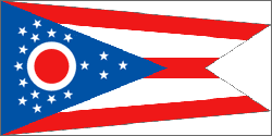
Ohio
"Buckeye State"
- Motto
- With God all things are possible
- Capitol
- Columbus
- Name Origin
- From an Iroquoian word meaning “great river”
- Statehood Date
- March 1, 1803 (17th)
Cities in Ohio
- Aberdeen
- Ada
- Addyston
- Adelphi
- Adena
- Akron
- Albany
- Alger
- Alliance
- Alvordton
- Amanda
- Amberley
- Amelia
- Amherst
- Amsterdam
- Andover
- Anna
- Ansonia
- Antwerp
- Apple Creek
- Aquilla
- Arcadia
- Arcanum
- Archbold
- Arlington Heights
- Arlington
- Ashland
- Ashley
- Ashtabula
- Ashville
- Athalia
- Athens
- Attica
- Aurora
- Austintown
- Avon Lake
- Avon
- Bailey Lakes
- Bainbridge
- Ballville
- Baltic
- Baltimore
- Barberton
- Barnesville
- Barnhill
- Batavia
- Bay View
- Bay Village
- Beach City
- Beachwood
- Beallsville
- Beaver
- Beavercreek
- Beaverdam
- Beckett Ridge
- Bedford Heights
- Bedford
- Beechwood Trails
- Bellaire
- Bellbrook
- Belle Center
- Belle Valley
- Bellefontaine
- Bellevue
- Bellville
- Belmont
- Beloit
- Belpre
- Bentleyville
- Benton Ridge
- Berea
- Bergholz
- Berkey
- Berlin Heights
- Bethel
- Bethesda
- Bettsville
- Beverly
- Bexley
- Blacklick Estates
- Blanchester
- Bloomdale
- Bloomingburg
- Bloomingdale
- Bloomville
- Blue Ash
- Bluffton
- Boardman
- Bolindale
- Bolivar
- Boston Heights
- Botkins
- Bowerston
- Bowersville
- Bowling Green
- Bradford
- Bradner
- Brady Lake
- Bratenahl
- Brecksville
- Bremen
- Brewster
- Bridgeport
- Bridgetown North
- Brimfield
- Broadview Heights
- Brook Park
- Brookfield Center
- Brooklyn Heights
- Brooklyn
- Brookside
- Brookville
- Brunswick
- Bryan
- Buchtel
- Buckeye Lake
- Buckland
- Bucyrus
- Burbank
- Burkettsville
- Burlington
- Burton
- Butler
- Butlerville
- Byesville
- Cadiz
- Cairo
- Calcutta
- Caldwell
- Caledonia
- Cambridge
- Camden
- Campbell
- Canal Fulton
- Canal Winchester
- Canfield
- Canton
- Cardington
- Carey
- Carlisle
- Carroll
- Carrollton
- Casstown
- Castalia
- Catawba
- Cecil
- Cedarville
- Celina
- Centerburg
- Centerville
- Chagrin Falls
- Champion Heights
- Chardon
- Chatfield
- Chauncey
- Cherry Grove
- Chesapeake
- Cheshire
- Chesterhill
- Chesterland
- Cheviot
- Chickasaw
- Chillicothe
- Chippewa Lake
- Choctaw Lake
- Christiansburg
- Churchill
- Cincinnati
- Circleville
- Clarington
- Clarksburg
- Clarksville
- Clay Center
- Clayton
- Cleveland Heights
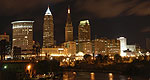
- Cleveland
- Cleves
- Clinton
- Cloverdale
- Clyde
- Coal Grove
- Coalton
- Coldwater
- College Corner
- Columbiana
- Columbus Grove
- Columbus
- Commercial Point
- Conesville
- Conneaut
- Continental
- Convoy
- Coolville
- Corning
- Cortland
- Corwin
- Coshocton
- Covedale
- Covington
- Craig Beach
- Crestline
- Creston
- Cridersville
- Crooksville
- Crown City
- Crystal Lakes
- Cumberland
- Custar
- Cuyahoga Falls
- Cuyahoga Heights
- Cygnet
- Dalton
- Danville
- Darbyville
- Day Heights
- Dayton
- De Graff
- Deer Park
- Defiance
- Delaware
- Dellroy
- Delphos
- Delta
- Dennison
- Dent
- Deshler
- Devola
- Dillonvale
- Dillonvale
- Donnelsville
- Dover
- Doylestown
- Dresden
- Drexel
- Dry Run
- Dublin
- Dunkirk
- Dupont
- East Canton
- East Cleveland
- East Liverpool
- East Palestine
- East Sparta
- Eastlake
- Eaton Estates
- Eaton
- Edgerton
- Edgewood
- Edison
- Edon
- Eldorado
- Elida
- Elmore
- Elmwood Place
- Elyria
- Empire
- Englewood
- Enon
- Euclid
- Evendale
- Fairborn
- Fairfax
- Fairfield Beach
- Fairfield
- Fairlawn
- Fairport Harbor
- Fairview Lanes
- Fairview Park
- Farmersville
- Fayette
- Fayetteville
- Felicity
- Findlay
- Finneytown
- Five Points
- Fletcher
- Florida
- Flushing
- Forest
- Forest Park
- Forestville
- Fort Jennings
- Fort Loramie
- Fort McKinley
- Fort Recovery
- Fort Shawnee
- Fostoria
- Frankfort
- Franklin Furnace
- Franklin
- Frazeysburg
- Fredericksburg
- Fredericktown
- Freeport
- Fremont
- Fruit Hill
- Fulton
- Gahanna
- Galena
- Galion
- Gallipolis
- Gambier
- Garfield Heights
- Garrettsville
- Gates Mills
- Geneva
- Geneva-on-the-Lake
- Genoa
- Georgetown
- Germantown
- Gettysburg
- Gibsonburg
- Girard
- Glandorf
- Glendale
- Glenmont
- Glenmoor
- Glenwillow
- Gloria Glens Park
- Glouster
- Gnadenhutten
- Golf Manor
- Grafton
- Grand Rapids
- Grand River
- Grandview Heights
- Grandview
- Granville
- Granville South
- Gratis
- Green Camp
- Green Meadows
- Green
- Green Springs
- Greenfield
- Greenhills
- Greentown
- Greenville
- Greenwich
- Groesbeck
- Grove City
- Groveport
- Grover Hill
- Hamden
- Hamersville
- Hamilton
- Hamler
- Hanging Rock
- Hanover
- Hanoverton
- Harbor Hills
- Harpster
- Harrisburg
- Harrison
- Harrisville
- Harrod
- Hartford
- Hartville
- Harveysburg
- Haskins
- Hayesville
- Heath
- Hebron
- Helena
- Hicksville
- Higginsport
- Highland Heights
- Highland Hills
- Highland
- Hilliard
- Hills and Dales
- Hillsboro
- Hilltop
- Hiram
- Holgate
- Holiday Valley
- Holland
- Hollansburg
- Holloway
- Holmesville
- Hopedale
- Howland Center
- Hoytville
- Hubbard
- Huber Heights
- Huber Ridge
- Hudson
- Hunter
- Hunting Valley
- Huntsville
- Huron
- Independence
- Irondale
- Ironton
- Jackson Center
- Jackson
- Jacksonville
- Jamestown
- Jefferson
- Jeffersonville
- Jenera
- Jeromesville
- Jerry City
- Jewett
- Johnstown
- Junction City
- Kalida
- Kelleys Island
- Kent
- Kenton
- Kenwood
- Kettering
- Killbuck
- Kingston
- Kipton
- Kirkersville
- Kirtland Hills
- Kirtland
- La Croft
- La Rue
- Lafayette
- Lagrange
- Lake Darby
- Lakemore
- Lakeview
- Lakewood
- Lancaster
- Landen
- Laura
- Laurelville
- Lawrenceville
- Leavittsburg
- Lebanon
- Leesburg
- Leetonia
- Leipsic
- Lewisburg
- Lewisville
- Lexington
- Liberty Center
- Lima
- Lincoln Heights
- Lincoln Village
- Lindsey
- Lisbon
- Lithopolis
- Lockbourne
- Lockington
- Lockland
- Lodi
- Logan Elm Village
- Logan
- London
- Lorain
- Lordstown
- Lore City
- Loudonville
- Louisville
- Loveland
- Loveland Park
- Lowell
- Lowellville
- Lucas
- Lucasville
- Luckey
- Ludlow Falls
- Lynchburg
- Lyndhurst
- Lyons
- Macedonia
- Mack North
- Mack South
- Macksburg
- Madeira
- Madison
- Magnetic Springs
- Magnolia
- Maineville
- Malinta
- Malta
- Malvern
- Manchester
- Mansfield
- Mantua
- Maple Heights
- Maple Ridge
- Maplewood Park
- Marble Cliff
- Marblehead
- Marengo
- Mariemont
- Marietta
- Marion
- Marshallville
- Martins Ferry
- Martinsville
- Marysville
- Mason
- Massillon
- Masury
- Matamoras
- Maumee
- Mayfield Heights
- Mayfield
- McArthur
- McClure
- McComb
- McConnelsville
- McDonald
- McGuffey
- Mechanicsburg
- Medina
- Melrose
- Mendon
- Mentor
- Mentor-on-the-Lake
- Metamora
- Meyers Lake
- Miamisburg
- Middle Point
- Middleburg Heights
- Middlefield
- Middleport
- Middletown
- Midland
- Midvale
- Midway
- Milan
- Milford Center
- Milford
- Millbury
- Millersburg
- Millersport
- Millville
- Mineral City
- Mineral Ridge
- Minerva
- Minerva Park
- Mingo Junction
- Minster
- Mogadore
- Monfort Heights East
- Monfort Heights South
- Monroe
- Monroeville
- Montgomery
- Montpelier
- Montrose-Ghent
- Moraine
- Moreland Hills
- Morral
- Morristown
- Morrow
- Moscow
- Mount Blanchard
- Mount Carmel
- Mount Cory
- Mount Eaton
- Mount Gilead
- Mount Healthy Heights
- Mount Healthy
- Mount Orab
- Mount Pleasant
- Mount Repose
- Mount Sterling
- Mount Vernon
- Mount Victory
- Mowrystown
- Mulberry
- Munroe Falls
- Murray City
- Napoleon
- Navarre
- Neffs
- Nelsonville
- Nevada
- New Albany
- New Alexandria
- New Athens
- New Bloomington
- New Boston
- New Bremen
- New Carlisle
- New Concord
- New Franklin
- New Holland
- New Knoxville
- New Lebanon
- New Lexington
- New London
- New Madison
- New Miami
- New Middletown
- New Paris
- New Philadelphia
- New Richmond
- New Riegel
- New Straitsville
- New Vienna
- New Washington
- New Waterford
- Newark
- Newburgh Heights
- Newcomerstown
- Newton Falls
- Newtonsville
- Newtown
- Ney
- Niles
- North Baltimore
- North Bend
- North Canton
- North College Hill
- North Fairfield
- North Fork Village
- North Hampton
- North Kingsville
- North Lewisburg
- North Madison
- North Olmsted
- North Perry
- North Randall
- North Ridgeville
- North Robinson
- North Royalton
- North Star
- North Zanesville
- Northbrook
- Northfield
- Northgate
- Northridge
- Northwood
- Norton
- Norwalk
- Norwood
- Oak Harbor
- Oak Hill
- Oakwood
- Oakwood
- Oberlin
- Obetz
- Ohio City
- Old Washington
- Olde West Chester
- Olmsted Falls
- Ontario
- Orange
- Oregon
- Orient
- Orrville
- Orwell
- Osgood
- Ostrander
- Ottawa Hills
- Ottawa
- Ottoville
- Owensville
- Oxford
- Painesville
- Pandora
- Park Layne
- Parma Heights
- Parma
- Parral
- Pataskala
- Paulding
- Payne
- Peebles
- Pemberville
- Peninsula
- Pepper Pike
- Perry Heights
- Perry
- Perrysburg
- Perrysville
- Phillipsburg
- Philo
- Pickerington
- Pigeon Creek
- Piketon
- Pioneer
- Piqua
- Pitsburg
- Plain City
- Pleasant City
- Pleasant Grove
- Pleasant Hill
- Pleasant Run Farm
- Pleasant Run
- Pleasantville
- Plymouth
- Poland
- Polk
- Pomeroy
- Port Clinton
- Port Jefferson
- Port Washington
- Port William
- Portage Lakes
- Portage
- Portsmouth
- Potsdam
- Powell
- Powhatan Point
- Proctorville
- Prospect
- Quaker City
- Quincy
- Racine
- Ravenna
- Rawson
- Rayland
- Reading
- Reminderville
- Republic
- Reynoldsburg
- Richfield
- Richmond Heights
- Richmond
- Richwood
- Ridgeway
- Rio Grande
- Ripley
- Risingsun
- Rittman
- Riverlea
- Riverside
- Roaming Shores
- Rock Creek
- Rockford
- Rocky Ridge
- Rocky River
- Rogers
- Rosemount
- Roseville
- Ross
- Rossburg
- Rossford
- Roswell
- Rushsylvania
- Rushville
- Russells Point
- Russellville
- Russia
- Rutland
- Sabina
- Salem
- Salineville
- Sandusky
- Sandusky South
- Sardinia
- Savannah
- Scio
- Sciotodale
- Scott
- Seaman
- Sebring
- Senecaville
- Seven Hills
- Seven Mile
- Seville
- Shadyside
- Shaker Heights
- Sharonville
- Shawnee Hills
- Shawnee Hills
- Shawnee
- Sheffield Lake
- Sheffield
- Shelby
- Sherrodsville
- Sherwood
- Sherwood
- Shiloh
- Shiloh
- Shreve
- Sidney
- Silver Lake
- Silverton
- Smithfield
- Smithville
- Solon
- Somerset
- Somerville
- South Amherst
- South Bloomfield
- South Canal
- South Charleston
- South Euclid
- South Lebanon
- South Middletown
- South Point
- South Russell
- South Salem
- South Solon
- South Vienna
- South Webster
- South Zanesville
- Spencer
- Spencerville
- Spring Valley
- Springboro
- Springdale
- Springfield
- St. Bernard
- St. Clairsville
- St. Henry
- St. Louisville
- St. Marys
- St. Paris
- Steubenville
- Stockport
- Stony Prairie
- Stoutsville
- Stow
- Strasburg
- Stratton
- Streetsboro
- Strongsville
- Struthers
- Stryker
- Sugar Bush Knolls
- Sugar Grove
- Sugarcreek
- Summerfield
- Summerside
- Sunbury
- Swanton
- Sycamore
- Sylvania
- Syracuse
- Tallmadge
- Tarlton
- Terrace Park
- The Plains
- The Village of Indian Hill
- Thornville
- Thurston
- Tiffin
- Tiltonsville
- Timberlake
- Tipp City
- Tiro
- Toledo
- Tontogany
- Toronto
- Tremont City
- Trenton
- Trimble
- Trotwood
- Troy
- Turpin Hills
- Tuscarawas
- Twinsburg
- Uhrichsville
- Union City
- Union
- Uniontown
- Unionville Center
- Uniopolis
- University Heights
- Upper Arlington
- Upper Sandusky
- Urbana
- Urbancrest
- Utica
- Valley Hi
- Valley View
- Valleyview
- Van Buren
- Van Wert
- Vandalia
- Vanlue
- Vermilion
- Verona
- Versailles
- Vienna Center
- Vinton
- Wadsworth
- Waite Hill
- Wakeman
- Walbridge
- Waldo
- Walton Hills
- Wapakoneta
- Warren
- Warrensville Heights
- Warsaw
- Washington
- Washingtonville
- Waterville
- Wauseon
- Waverly City
- Wayne Lakes
- Wayne
- Waynesburg
- Waynesfield
- Waynesville
- Wellington
- Wellston
- Wellsville
- West Alexandria
- West Carrollton City
- West Farmington
- West Hill
- West Jefferson
- West Lafayette
- West Leipsic
- West Liberty
- West Manchester
- West Mansfield
- West Milton
- West Portsmouth
- West Salem
- West Union
- West Unity
- Westerville
- Westfield Center
- Westlake
- Weston
- Wetherington
- Wharton
- Wheelersburg
- White Oak East
- White Oak
- White Oak West
- Whitehall
- Whitehouse
- Wickliffe
- Wilberforce
- Willard
- Williamsburg
- Williamsport
- Willoughby Hills
- Willoughby
- Willowick
- Willshire
- Wilmington
- Wilmot
- Winchester
- Windham
- Wintersville
- Withamsville
- Woodbourne-Hyde Park
- Woodlawn
- Woodmere
- Woodsfield
- Woodstock
- Woodville
- Wooster
- Worthington
- Wright-Patterson AFB
- Wyoming
- Xenia
- Yellow Springs
- Yorkville
- Youngstown
- Zaleski
- Zanesfield
- Zanesville
NOTE: Not all cities are displayed. Please narrow your selection by using the search above.
Official Symbols
A state's official symbols represent the composition and culture of the land and people who live and have lived here. Below are the symbols of Ohio along with the year they became official.
| Flower | Scarlet Carnation (1904) |
| Tree | Buckeye (1953) |
| Bird | Cardinal (1933) |
| Insect | Ladybug (1975) |
| Gemstone | Flint (1965) |
| Song | “Beautiful Ohio” (1969) |
| Beverage | Tomato Juice (1965) |
| Fossil | Trilobite (1985) |
| Animal | White-Tailed Deer (1988) |
| Wildflower | Large White Trillium (1987) |
Demographics
- Population Density
- 277.3 people per square mile
Geography and Weather
- Land Area
- 40,948 sq mi. (106,055 sq km)
- Lowest Elevation
- 0 ft (0 m)
- Average Elevation
- 850 ft (259.08 m)
- Highest Temperature Recorded
- 113°F (45°C) on July 21, 1934
- Lowest Temperature Recorded
- –39°F (–39°C) on February 10, 1899


